
This release adds:

  • New regional analysis options, including easier ways to activate travel time and detailed transit path results
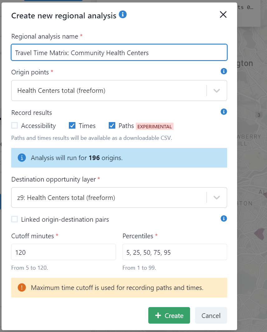
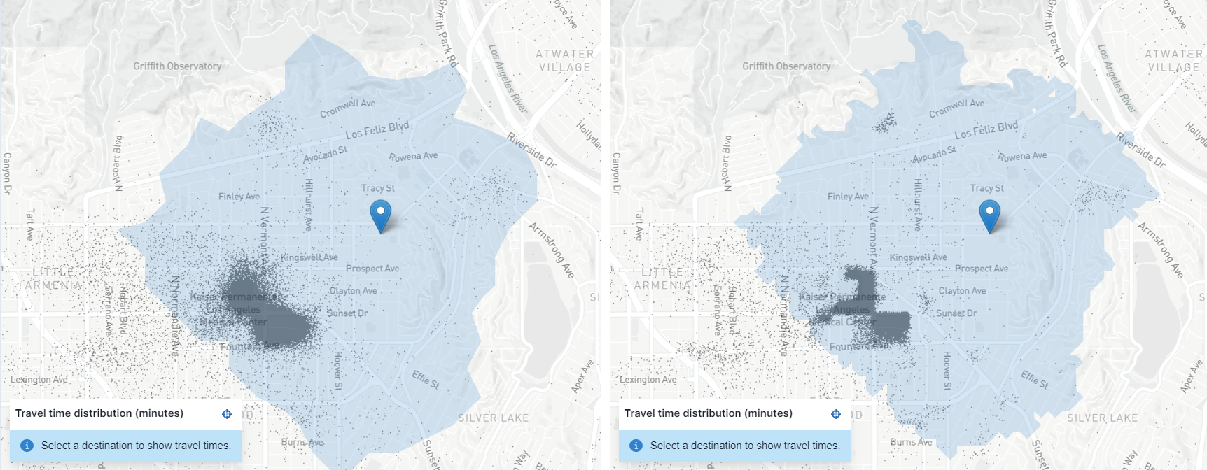
Configuring travel time and path analyses
  • Smoother computational scaling for regional analyses
  • Updated employment/workforce data for US regions (using the 2019 release of LODES)
  • Clearer descriptions of certain uncommon errors

This release adds:

  • Zoom level selectors that unlock higher spatial resolutions for isochrones, spatial datasets, and accessibility results.
    Isochrones with grid cell resolution z9 (left) vs. z11 (right)
    Isochrones with grid cell resolution z9 (left) vs. z11 (right)
    Isochrones with grid cell resolution z9 (left) vs. z11 (right)
  • Additional base map layers when viewing network bundles and data sources
  • Information on the selected analysis origin, and a button to set the origin to the center of the map
  • Bugfixes for importing modifications from other projects, and to eliminate occasional error messages when editing timetables

  • Ignore GTFS stops without coordinates (e.g., pathways nodes).
  • Show alert when a regional analysis might be stalled.
  • Show a loading indicator when waiting for single point analysis results.
  • Require non-empty values in all name fields.
  • Display upload errors and correct GeoTIFF handling for Data Sources.